I left my camp along Calf Creek and headed north on UT-12 headed for Capital Reef National Park. But only a few miles up the road in Boulder, UT, I noticed the sign for the Burr Trail. I had heard that it was a very scenic drive, so I decided to have a look for myself.
The Burr Trail is another route which covers 68 miles from the town of Boulder, UT south to Bullfrog on Lake Powell. It is paved for the first 18 miles where it reaches the southern end of Capital Reef and the Waterpocket Fold. It was named after John Burr who established a trail to move cattle back and forth between winter and summer ranges. This cattle trail came to be known as the Burr Trail.
After spending about an hour exploring the first 10 miles or so of the Burr Trail, I decided I needed to turn around and get headed for Capital Reefs northern section, as I had no idea what the dirt road sections off the Burr Trail would be like.
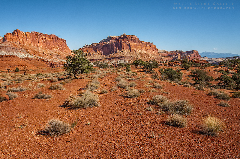
The main attraction of Capital Reef National Park is the Waterpocket Fold. A 100 mile long warp in the Earth’s crust, created by geologic events that formed the Rocky Mountains. The landmass was forced to the west, and the fold was created along an ancient fault. The rock layers on the west side of the Waterpocket Fold have been lifted more than 7000 feet higher than the layers on the east.
Entering the park I passed by the campground and decided to not camp there as it had the feel of camping in a city park with no privacy. So I decided to drive the scenic section and then push on to Moab where I would get a hotel for the night, with the plan of camping in Arches NP the following two nights.


More great photos. Keep it up and I’ll be able to enjoy all the National Parks and Monuments without ever leaving home!